
Walk a Wallingford Street
A useful Wallingford street directory search moves from the present parcel to the record that best fits the question. Begin with the standardized address in the Assessor's database. Keep the PID, the internal parcel identifier, and the MBLU, the map-block-lot-unit code. Those keys survive spelling changes better than a street label. Then separate the situs address, where the parcel sits, from the mailing address used for tax notices.
- Search the Vision assessment database by address. Save the owner, situs, mailing address, PID, MBLU, valuation date, sale entry, and linked card.
- Open the street listing and relevant Town tax-map PDF. Check nearby lots, map edges, easements, and any “lot on other map” note.
- Use the displayed book and page to enter the Wallingford Town Clerk deed chain. Read the legal description, not just the postal address.
- For a historic date, search the numerical section of the nearest city-directory issue, then confirm each name in its alphabetical part.
- Use voter, court-property, building, or planning records only for a specific lawful question. None is a full occupant list.
This flow keeps ownership, occupancy, and mail delivery distinct. It also gives a fallback when one search fails: the parcel code leads to the map, the map leads to a lot, and the deed description leads to older books.
Wallingford Street Search Fields
The free Vision interface is the main residential address search. It reflects Wallingford's October 1, 2024 revaluation. The town says assessed value is 70 percent of fair market value as of that date and warns against simply applying the current mill rate. These controls were observed in the public search.
| Control | Input | Search behavior |
|---|---|---|
| Address | Autocomplete | At least three characters |
| Owner | Last name | At least one character |
| Acct# | Account | At least one character |
| MBLU | Seven segments | Map, cuts, block, lot, unit |
| PID/Internal Id | Identifier | At least one character |
| All | Broad text | Searches indexed fields |
A “Past Owner” option appeared in page code but not in the visible control. Do not depend on it. Use parcel ownership history and the Town Clerk index instead. Vision also has Street Listing and Sales Search tabs; no ZIP filter was confirmed.
The Town Hall sample parcel displays the difference between a site and a mailing line.
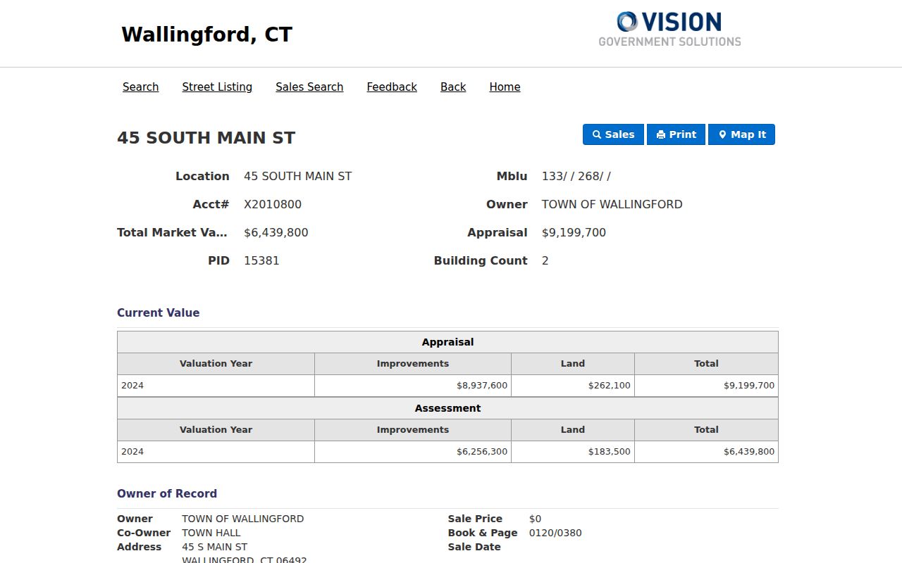
As a civic building, it safely demonstrates owner, co-owner, address, PID, MBLU, valuation, sale, building, and card fields without presenting the card as a household roll.
Wallingford Records by Address
No single Wallingford record names everyone on a street. Sources overlap, and several require a clerk, written request, or visit. Connecticut has no operating New Haven County recorder or assessor; these records begin with town offices or state systems.
| Source | Keeper | What it shows | Access |
|---|---|---|---|
| Assessment card | Wallingford Assessor | Owner, situs, mailing, parcel, sale, building | Vision or office |
| Tax map | Assessor | Lots, acreage, easements, map edges | PDF or office |
| Deed | Town Clerk | Parties, book/page, description, restrictions | Recordhub or counter |
| Building/PZ file | Town departments | Applicant, work, approval, date | Address request |
| Voter record | Registrar/SOTS | Lawfully public registration fields | Lookup or file request |
| Numerical directory | Public Library | Historic names by house number | Digital viewer or collection |
Ask each custodian for a narrow record set and date span. Connecticut FOIA permits inspection or copies of nonexempt public records, but it cannot open a record protected by another statute.
Note: New Haven County is geographic context, not a county records office, so route Wallingford parcel questions to the town.
Map Wallingford Street Parcels
The town's tax-map index covers sheets 1 through 233. The 2025 cover sets a scale of one inch to 200 feet. Symbols mark parcel lines, water, pavement, easements, landhooks, acreage, addresses, and lots carried onto another map. The maps serve assessment work. They are not surveys.
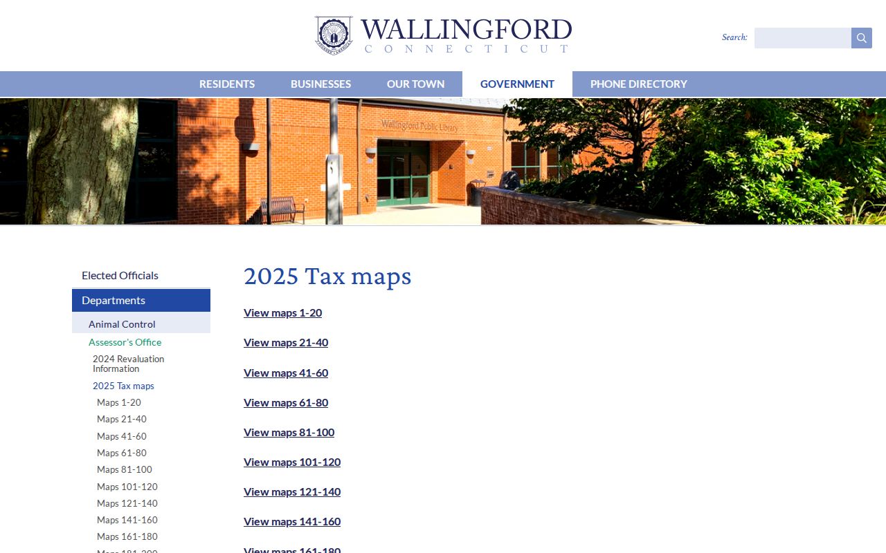
The index matches Vision's MBLU map number to a sheet. Record the PDF issue label with its URL, since a live page may show a newer index state. Follow a printed map-edge reference before deciding a lot has disappeared.
- Parcel
- A tract represented as one assessment unit. It may not equal one household.
- Situs address
- The parcel's physical location, distinct from the tax-mailing address.
- Plat
- A recorded map of lots, roads, or subdivisions; confirm its survey status and reference.
- Criss-cross directory
- A directory arranged by street and number rather than only by surname.
Compare Wallingford Map Tools
Vision and MapXpress do different work. Vision is primary for residential parcel facts. MapXpress is an official commercial and industrial GIS with lot boundaries, address tools, and source data. Its guide says to enter a house number, prefix, or part of a street. If a full address fails, omit the suffix.
| Tool | Best use | Limit |
|---|---|---|
| Vision | Owner, address, account, PID, MBLU, card | Ownership is not residence |
| MapXpress | Commercial geometry, land use, edit source | No general residential viewer found |
| Tax maps | Sheet context, lots, easements, edges | Not a survey |
MapXpress can explain differences. Its layer notes split and combined parcels, boundary adjustments, lot-number changes, address changes, and new parcels. Sources include tax maps, surveys, aerials, subdivision plans, and road drawings. This is valuable provenance, not an automatic neighbor report.
Follow Wallingford Street Deeds
When Vision displays a sale book and page, continue with Wallingford Recordhub. A no-subscription route allows index viewing after account creation. Index and image plans differ, and Cott advertises $2 printed pages. Checked August 20, 2026, the land index began January 17, 1963, while images began January 20, 1963. Maps and surveys reached November 1, 1871.
Search grantor and grantee roles, then read the instrument. A grantor gives an interest; a grantee receives it. Capture type, recording date, book/page, parties, legal description, map links, and prior instruments. For older deeds, contact the Wallingford Town Clerk at 45 South Main Street, Room 108. There is no New Haven County recorder.
Note: The index starts three days before its images, so preserve index and document-image availability as separate facts.
Old Wallingford Street Labels
A failed modern query may reflect naming, not a missing record. Older instruments can name the Borough of Wallingford. Borough and town consolidated on January 1, 1958, yet borough wording remains in town-cited deeds from 1924, 1947, and 1950. Test both forms when following a parcel or easement.
No verified townwide renumbering or annexation conversion year was found. Compare directory street lists, deed descriptions, old maps, current sheets, and PID or MBLU. Do not invent an old-to-new number match. The Historical Society and Town Clerk are sound fallbacks.
The older center offers useful fixed points. Wallingford's official history places the first settlement lots along present Main Street. Town Hall occupies the former 1916 high school at 45 South Main Street, while the Parsons House at 180 South Main dates to 1759. The railroad station dates to 1871, and the Wallace Hose House at 9 South Cherry Street dates to 1895. These documented landmarks can orient a map or directory page, but they do not prove that nearby house numbers stayed unchanged. Match the landmark, road pattern, lot description, and dated source before linking an old entry to a current address.
Wallingford Files Behind Addresses
The Building Department issues permits and certificates. Planning and Zoning keeps commission files, maps, and zoning-board records. No public permit or code-case index was found. Ask by address, parcel, project or permit date, applicant, and file type.
A new permit schedule took effect August 3, 2026. It uses labor and material cost rounded to the next thousand, at $16 per thousand with a $30 minimum. Check the current notice because fees change. A permit names a project and applicant; it does not prove who lived there.
Historic Wallingford Streets by Number
For old occupants, use the digitized Wallingford directories. The uneven run has issues from 1883 through 2000. The 1931 volume includes a numerical section of streets, householders, and businesses. Search a street and number, open the image, and confirm names alphabetically. OCR can merge lines and misread names.
The collections and gaps belong on the Wallingford city directory page. For a by-address task, save the issue date, printed address, page, name, classification, and image confidence. A business is not proof of a home, and an empty OCR result is not proof of absence.
Limits of Wallingford Street Records
A parcel card identifies a tax owner, not every resident. A mail addressee may be an estate, trust, business, town, fiduciary, or person elsewhere. Voter files cover registration, not a whole household. Directories are dated publisher snapshots. Utility customers, guests, unregistered occupants, and protected voters do not create a complete public roll. Source dates matter when names and parcels change.
Connecticut voter privacy and Safe at Home can protect addresses in defined cases. DMV address data is restricted. Use the Wallingford street directory for family history, parcel research, civic questions, and scam checks. Confirm current claims with the custodian and source date.
Lawful use. Wallingford address records must not be used to stalk, harass, intimidate, or harm a person. Respect protected addresses and source limits.